Mountaineering in Uzbekistan
Activity holidays in Uzbekistan. Tours, outdoors in mountains
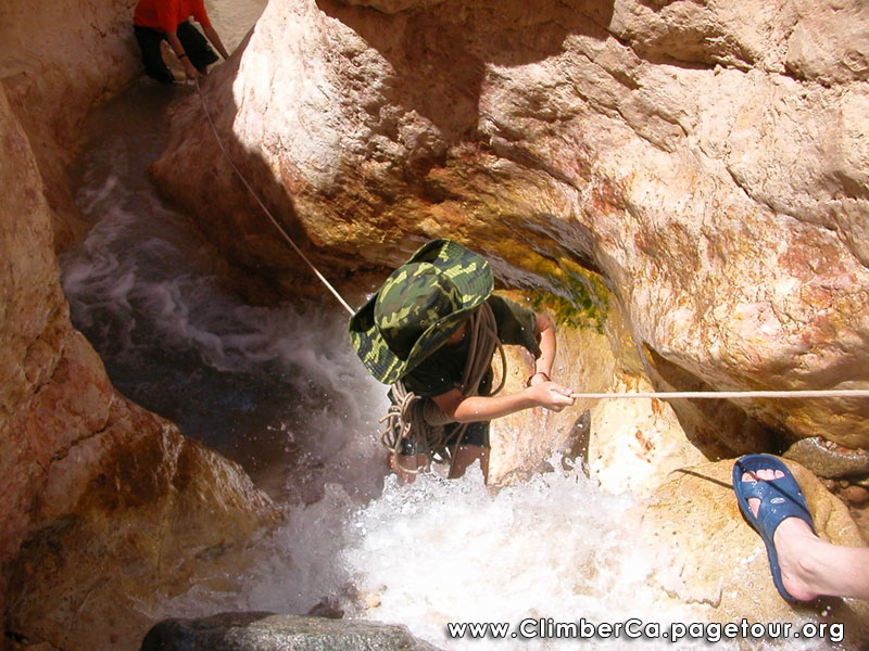
According to data of “Uzbektourism” the active forms of eco-tourism like rafting, hiking, trekking, rock climbing, speleology, horseback riding, and mountaineering come to 60 percent of all tourism in the Tashkent province. Locals, and also tourists from many other ountries prefer mentioned activities in Uzbekistan Mountains near to Tashkent. Historical-cognitive tourism amounts about ten percent. Inactive forms of eco-tourism attract less than 30 per cent of tourists.

|

|

|

|

|

|

|

|

|

|

|
Mountaineering in Uzbekistan

Mountaineering is the sport, hobby or profession of walking, hiking, trekking and climbing up mountains. It is also sometimes known as alpinism, particularly in Europe. While it began as an all-out attempt to reach the highest point of unclimbed mountains, it has branched into specializations addressing different aspects of mountains and may now be said to consist of three aspects: rock-craft, snow-craft and skiing, depending on whether the route chosen is over rock, snow or ice. All require great athletic and technical ability, and experience is also very important.
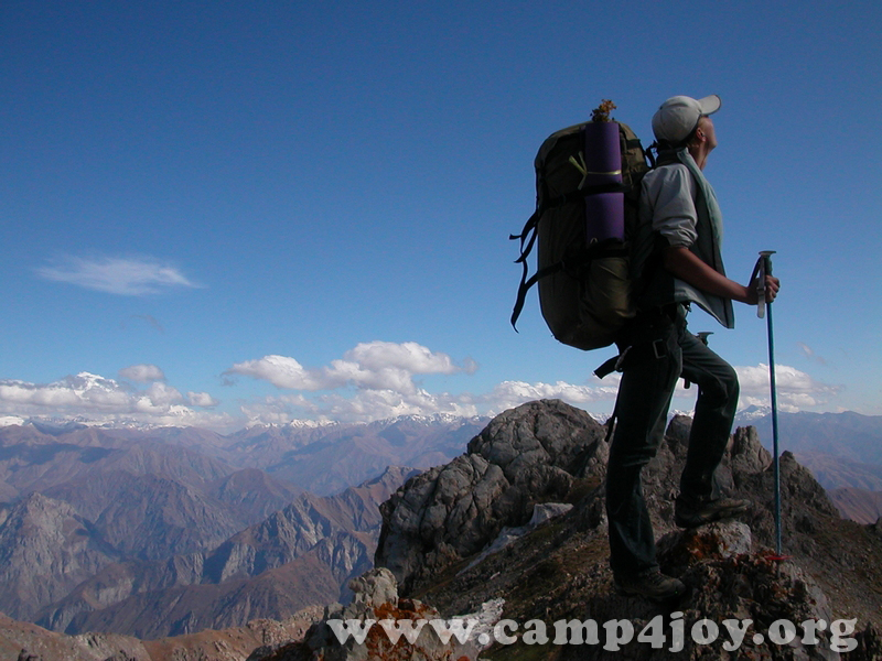
Trekking in the Nurata mountains
Contact information
https://t.me/ClimberCA – telegram
WhatsApp / Viber +7966 065-53-44
e-mail – your@climberca.com
Sketch itinerary 2023
Day 1.
12.00 Arrival in the Majerum village, accommodation in a guest house. The guest house has 4 rooms (15 beds).
13.00 Lunch.
14.00-18.00 Hike around the village (4 km)
19.00 Dinner.
Day 2. Hike
from the Majerum village to the Hayat village.
7.00 Breakfast.
8.00-12.00 Visiting a water mill, the 2000-year-old Oriental biota tree and the ruins of an ancient mosque in the Majerumsay valley. Then cross a ridge to the neighboring of the Andygen village.
13.00 Lunch on a tapchan in the Andygen village.
14.00 Walk rond the Andygen village (the ancient mosque Avlieot and Mazar), then hike along the foothills to the Hayat village.
18.00 Accommodation in the guest house.
19.00 Dinner.
Day 3.
7.00 Breakfast.
8.00-12.00 Hike rond the Hayat village, then along the Hayatsaya valley (7 km), visit the ruins of the old village and Severtsov sheep nursery.
13.00 Lunch.
14.00-18.00 Workshop on baking home bread in a tandoor and cooking pilaf.
19.00 Dinner
Day 4. Hike
from the Hayat village to the Ukhum village.
7.00 Breakfast.
8.00-12.00 Hike from Hayat village through a small mountain ridge to the neighboring Ukhum village (5 km).
12.00 Accommodation in a guest house in the Ukhum village.
13.00 Lunch.
14.00-18.00 Hike round the Ukhum village, to the mazar Eshon-bobo and to the petroglyphs in the Tykchasay valley (10 km).
19.00 Dinner.
Day 5.
7.00 Breakfast
8.00 Departure
Short information – +99898 3039846
 |
||||
 |
||||
 |
Uzbekistan mountains
The mountains of Uzbekistan enter in structure of Tyan-Shan and Alay mountain systems. On territory turn the western spurs of Tyan-Shan and Gissar-Alay mountain system. To south and west they gradually lower and turn to plains.
Internal (tectonic) power of Earth formed folds grown the powerful ranges of mountains.
The mountains and foothills with brook relief, located in east and south-east part of Uzbekistan, where they unite with powerful mountain
deep brook massive on territory of Kirgizya and Tadjikistan. Mainly this Ugam, Pskem, Chatkal, Kuramin ranges and their western and south-western spurs, concerning to Western Tyan-Shan system and Turkestan, Zerafshan and Gissar ranges with their continuous on south-western – Babatag and Kugintangtau ranges, concerning to Gissar-Alay system.
Entering on territory of Uzbekistan its spurs formed radiating bundle of mountain chains, constantly less in north-western and south-western directions. The character example is Karjantau, Maygashkan and Surenata ranges in western Tyan-Shan system and Nuratau, Aktau and Kuratau ranges and Karatepa and Ziadin-Zirabulak mountains, being the last of Pamir-Alay.
Entering in Western Tyan-Shan system the mountain ranges (Karjantau, Ugam, Pskem, Chatkal, Kuramin) began from Talass Alatau (on border with Kirgizstan), further as fan radiate from here and continuos to north-east to south-west.
The more high point of Talass Alatau is mountain Manas (4482m). The high point of Chatkal range on territory of Uzbekistan – Greater
Chimgan peak (3309 m). Between Chatkal and Kuramin ranges located Akhangaran valley.
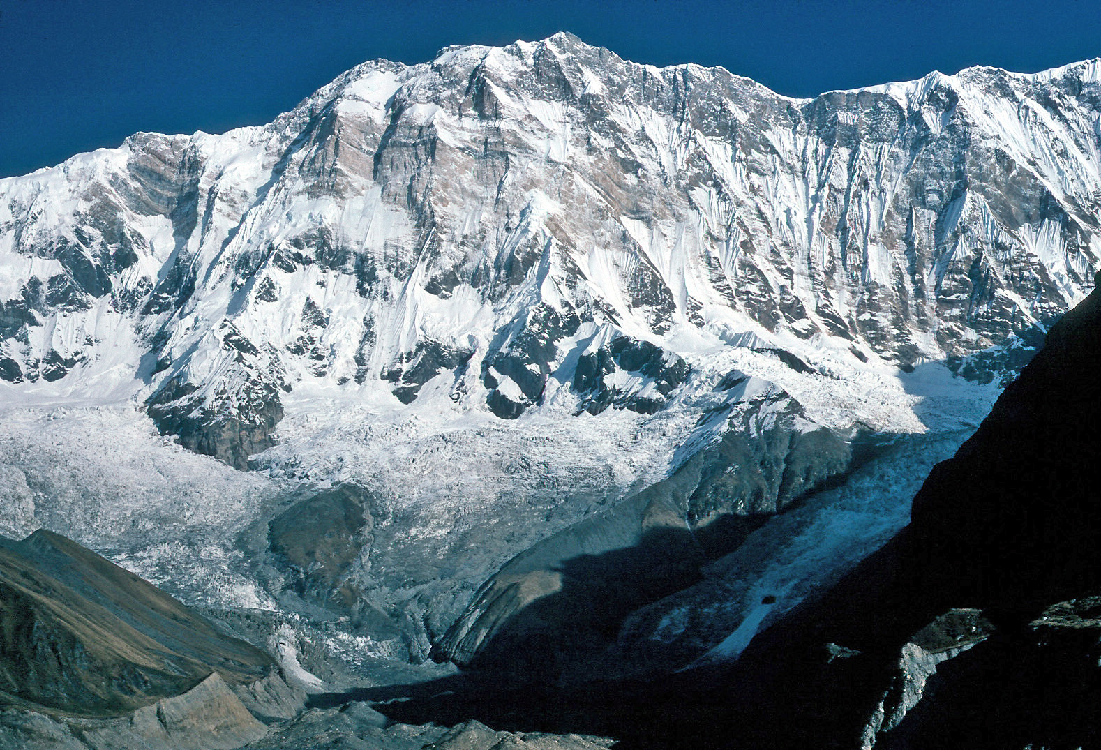
The apexes of Western Tyan-Shan covered with snow and glaciers.
The Chatkal and Kuramin ranges border on north with Fergana valley. From east she borders with Fergana range, from south with Alay and Turkestan ranges. To north-west from Turkestan range raises the Malguzar range, to south-west Chumkartau range. Only the north slopes of Chumkartau entering on territory of Uzbekistan. The valley of Sanzar river separate the Malguzar mountains from Nuratau mountains. The weak point in this valley named Tamerlan gates.
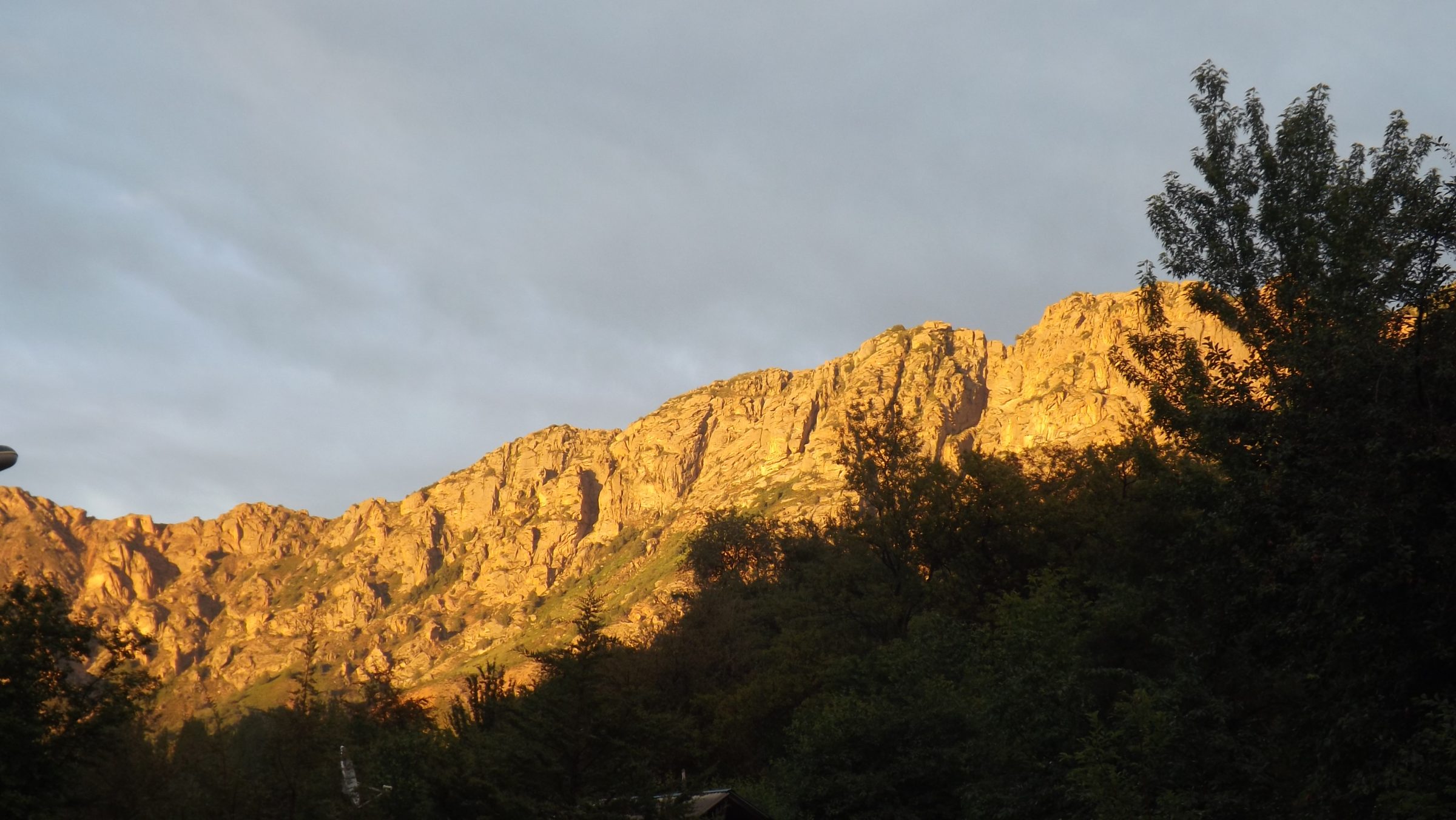
The Nuratau mountains stretch on 180 km. Their north slope is steep, the south slope is gently sloping. The high point of North part of Nuratau mountains is Khayatbashi apex (2165 m). The south part of Nuratau mountains consists from separate apexes (Aktau, Karatau, Karagatau, Gabduntau).
On the south and as parallel to Turkestan range located Zarafshan range. With self eastern part he entering on territory of Tadjikistan. On south from Zarafshan range located Gissar range and his south-western spurs (Yakkobag, Surkhantau, Kugikantau, Baysuntau, Chakgarand other). Here located the highest point of Uzbekistan – the Khazret Sultan (4643 m).
In western part of Gissar range are two glaciers – Batirbay and Severcev. On south of Uzbekistan along of border with Tadjikistan located Babatag range. The high point – Zarkasa (2292 m). The main features of orography of Uzbekistan connected with features of geological structure of above-mentioned the mountain systems.
This bond found expression in these, that between mountain ranges located spacious foothill and intermountain depressions, the large from which is Tashkent-Golodnosteppe, Fergana Zarafshan, Kashkadarya and Surkhandarya.
Uzbekistan Mountains near to Tashkent
Chimgan Mountains
The Chimgan Mountains are invariably attractive for mountaineers. The wide variety of Chimgan and its surroundings allows the activity in all kinds of mountaineering and landscape tourism. Mountains (Small and Greater Chimgan Peaks – 3,309 m) of Chatkal range, plateaus, the Black Waterfall (40 m) at the lower part of Greater Chimgan Peak, Gulkam waterfalls, attract a lot of tourists from Uzbekistan and abroad.
Ugam & Karjantau ridges
Another attractive place for mountaineering is situated on Ugam ridge and on the southern; slopes of the Karjantau ridge of the Western
Tyan-Shan system. There are following natural sites, which are of interest of mountaineers in area of Ugam & Karjantau ridges:
• Peak Mingbulak (2,628 m) – the highest peak of the Karjantau ridge.
• Qizilsuv waterfalls – the pictorial cascades that flow at the sinuous river gorges of Qizilsuv Mountain River.
• Loquacious cave is located on plateau Ghiza, 20 km from village Humsan, in a funnel-shaped hollow. On the bottom of the hollow, in the exposure of grey limestone, there is a 1×1 m rectangular aperture transforming to a 1.5 m high sloping tunnel. Its floor is covered with
lumps, ceiling being arcaded. This tunnel is 20 m long and leads to the inner larger part of the cave. A ladder is needed in order to proceed
into the cave as there is a 6 m high prominence. Then the floor levels out, height reaching 20-30 m. The cave is so named due to a treamlet flowing through it.
• Arkutsay – exposure of loess stratum. The site is 3 km west of Humsan, on the right bank of the Ugam River. Section of the formation represents the wall of a small landslide breakaway and is a stratum of interstratifying loess-like loams of Quaternary and fossil soils horizons. The section is unique as it exposes more than 80 m thick deposition of rocks.
• Kyrk-Kokyl waterfall (in Uzbek “Kyrk-Kokyl” means 40 plaits) – pictorial waterfall at Pustonlyk – confluent of Ugam River, 9 km from Humsan village.