Fann Mountains Trekking

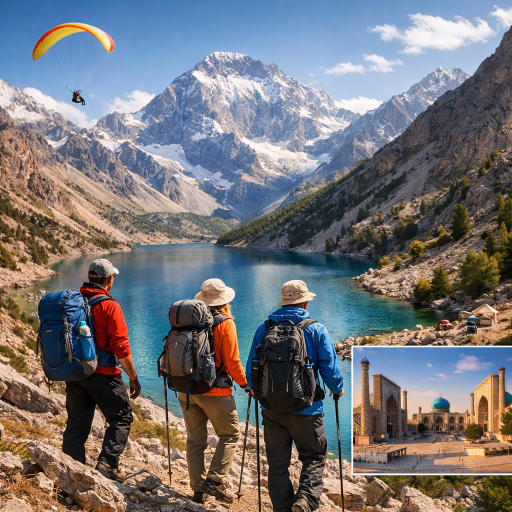
The Fann Mountains are one of the most spectacular trekking destinations in Central Asia. Located in the Pamir-Alay system of Tajikistan, this region offers alpine lakes, dramatic rock walls, and high mountain passes reaching up to 4500 meters.

This 12–14 day trekking program is a complete trans-Fann route, crossing the mountains from north to south and finishing in the legendary Seven Lakes region.

Duration: 12–14 days
Region: Fann Mountains, Tajikistan
Grade: Moderate to challenging
Season: June – September
Start: Samarkand (Uzbekistan)
Finish: Seven Lakes (Tajikistan)

Why Choose This Trek?

  • Complete crossing of the Fann Mountains
  • Iconic alpine lakes: Kulikalon, Alauddin, Mutnye, Allo
  • High mountain passes up to 4500 m
  • Remote wilderness with minimal infrastructure
  • Flexible trekking formats: from expedition style to комфорт

Route Highlights

  • Kulikalon Lakes beneath 5000 m peaks
  • Alauddin Lakes – the most famous lakes of the Fanns
  • Mutnye Lakes under Chimtarga (5489 m)
  • Chimtarga Pass (4500 m)
  • Allo Lakes and Zindon Valley
  • Seven Lakes (Haft Kul)

Day-by-Day Itinerary

Day 1 – Transfer to Artuch Base
Cross the Uzbekistan–Tajikistan border near Samarkand. Transfer via Pendjikent to Artuch Mountain Base. Optional acclimatization hike to Chukurak and Ziyorat lakes.

Day 2 – Kulikalon Lakes
Trek over an easy pass to Kulikalon Lakes (2800 m). Camp at Bibi-Djanat Lake under massive rock walls.

Day 3 – Alauddin Pass (3730 m)
Cross Alauddin Pass and descend to the famous Alauddin Lakes.

Day 4 – Mutnye Lakes (3430 m)
Trek to Mutnye Lakes beneath Chimtarga Peak. Establish high camp.

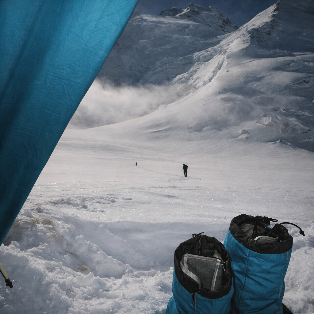
Day 5 – High Camp (4500 m)
Move to high camp below Chimtarga Pass. Overnight at altitude.

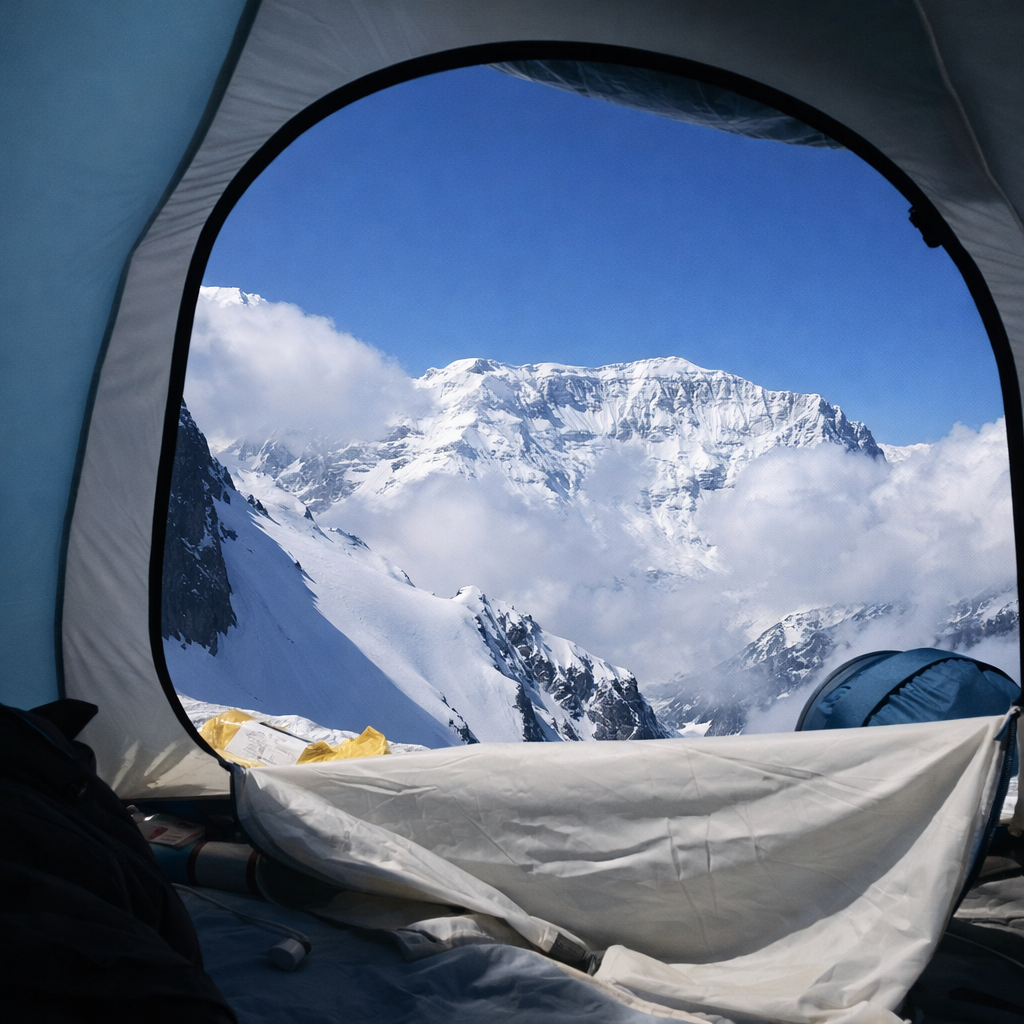
Day 6 – Chimtarga Pass (4500 m)
Cross the highest pass of the trek. Long descent to Greater Allo Lake (3140 m).

Day 7 – Zindon & Archamaidan Valleys
Descend along Zindon River, continue via Archamaidan Valley. Camp near Sarymat confluence.

Day 8 – Munora Approach
Trek toward Munora Pass. Optional light exploration of side valleys.

Day 9 – Munora Pass
Cross Munora Pass and descend into Sarymat Valley.

Day 10 – Tavasang Pass (3450 m)
Cross Tavasang Pass and reach Marguzor (Seven Lakes).

Day 11 – Rest Day
Explore the Seven Lakes area.

Day 12 – Return
Transfer back toward Uzbekistan.

Trekking Formats & Pricing

Note: Prices are per person in USD, based on a minimum group of 3 participants. Final cost depends on logistics, season, and services.

1. Classic Trek (Backpack)

~70 USD per day

Participants carry part of the expedition gear. The guide acts only as a route leader (not a porter or cook). Requires good physical condition. The most authentic and budget option.

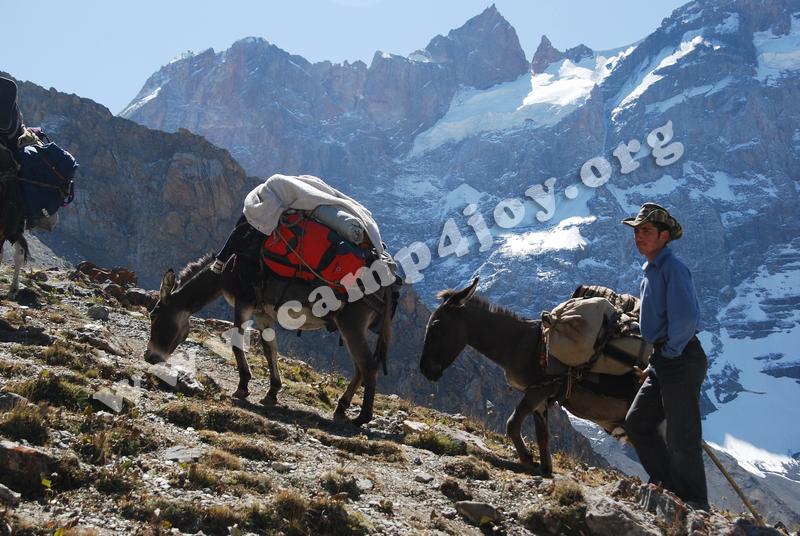
2. Classic Trek (Pack Animals Support)

~100 USD per day

Part of the equipment is transported by horses or mules. Participants still carry personal gear. Balanced option between effort and comfort.

3. Trek Without Backpacks

~160 USD per day

Main load is transported by pack animals. Participants hike with light daypacks only. Ideal for enjoying landscapes with reduced physical strain.

4. Comfort Trek (With Cook)

~180 USD per day

Full-service trekking with pack animals and a professional cook. The guide focuses on safety and route management. Maximum comfort in mountain conditions.

Difficulty Level

This trek is moderate to challenging. It includes multiple high passes up to 4500 m and requires good physical fitness. No technical climbing skills are required.

Who Is This Trek For?

  • Experienced hikers and trekkers
  • Adventure travelers seeking remote regions
  • Photographers and nature lovers
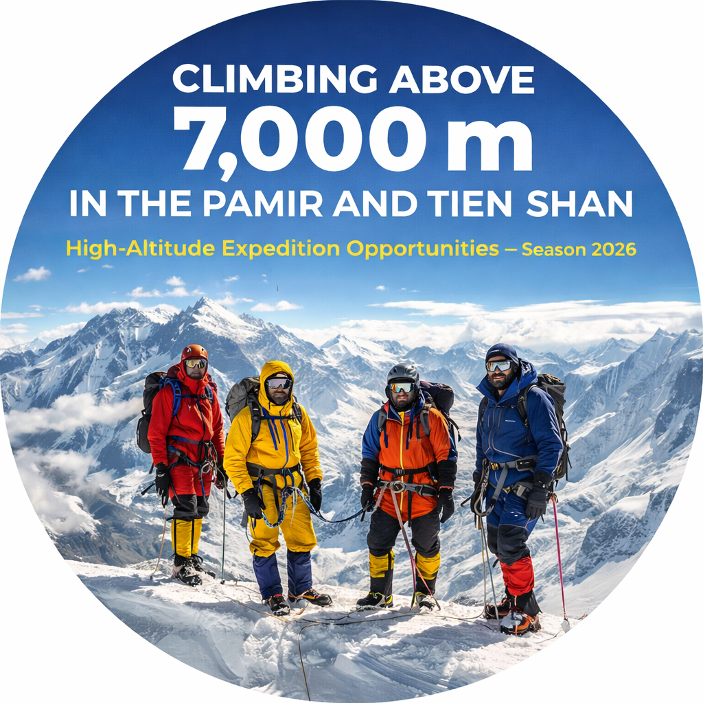
  • Climbers preparing for higher altitude expeditions

Plan Your Trek

Tell us your preferred trekking format, duration, and experience level — we will customize the route for you.

Supplier of services: ClimberCA International Consortium.
https://t.me/ClimberCA – telegram
+7966 065-53-44 – whatsapp/viber
e-mail: your@climberca.com
Note: ClimberCA provides top-quality services at competitive prices. Explore the full range of services on the website—some are truly unique and unmatched on the market.

Peak Korzhenevskaya is the third-highest peak in the Pamir range and one of the five required summits for the prestigious “Snow Leopard” award. Located on the Academy of Sciences Range, approximately 13 km from Peak Communism (Ismoil Somoni), its classic ascent via the South Ridge (Tsetlin Route) is rated Russian Grade 5A. It is widely considered the second easiest of the former Soviet 7,000m peaks after Peak Lenin.


1. Overview & Approach

  • Route: South Ridge (The Classic Tsetlin Route).

  • Grade: 5A.

  • First Ascent: Team led by V. Tsetlin in 1966.

  • Vertical Gain: Approx. 3000m from Base Camp.

  • Base Camp: Moskvina Glade (4100m). A modern, well-equipped base camp situated between Peaks Korzhenevskaya and Communism, featuring modular accommodations, electricity, internet, a banya, and hot showers. Access is via helicopter from Dushanbe or the town of Jirgital.


2. The Easier Ground: Logistics & Comforts

Despite being a serious 7,000m peak, the classic route offers several factors that facilitate a successful climb:

  • Established Infrastructure: Moskvina Glade provides a high level of comfort. Helicopter access to the region eliminates a long, arduous trek-in, conserving energy for the climb.

  • Fixed Ropes: On all key technical sections, commercial operators (such as Ak-Sai Travel) fix permanent ropes, greatly simplifying progression and allowing climbers to travel with minimal technical gear. The main trail from Base Camp to the upper camps is well-trodden and distinct.

  • Spacious Camp Sites: The route features several naturally accommodating campsites:

    • Camp 5300m: Located on stable moraine.

    • Camp 5800m (The Grotto): Situated in a natural “pocket” beneath an overhanging rock wall, offering excellent protection from rockfall.

    • Camp 6400m: A vast, flat snow plateau on the ridge with ample room for numerous tents.

  • Moderate Technical Demand: Compared to other 7,000m peaks, the route is not overly technical. The primary challenges are altitude, endurance, and objective hazards rather than steep, technical rock or ice climbing.


3. The Challenges: Serious Hazards & Objective Dangers

The main difficulties stem from classic high-altitude mountain hazards.

  • The Icefall & Crevasses: The route begins immediately on the Moskvina Glacier, requiring negotiation of a heavily crevassed icefall. Movement must be roped and follow the marked trail diligently, as a crevasse fall is a primary risk.

  • Rockfall (The Most Serious Objective Hazard): This is arguably the greatest danger on the mountain. Significant sections of the route lie beneath unstable rock faces and scree slopes.

    • The slope from BC to Camp 5100m is a steep, loose scree field, prone to rockfall.

    • The traverse from Camp 5800m to the saddle at 6100m passes directly beneath seracs and rock bands, making it extremely dangerous from falling objects.

  • Altitude Acclimatization: Climbing to 7105m requires a rigorous acclimatization protocol. The standard schedule involves multiple rotations with nights at progressively higher camps (5100m, 5300m, 5800m, 6100m, 6400m) to allow physiological adaptation. Pushing too fast invites altitude sickness.

  • Volatile Weather: Conditions in the high Pamir are notoriously unstable. Sudden snowstorms and whiteouts can strike without warning, making navigation treacherous. Summit temperatures can plummet to -45°C.


4. The Technical Keys: A Section-by-Section Breakdown

The classic route can be broken down into four distinct sections, each with its own character.

Phase 1: Approach to the High Moraine (BC — 5300m)

  • Section: BC (4100m) → Camp 5100m → Camp 5300m.

  • Description: From Moskvina Glade, the trail leads onto the heavily crevassed Moskvina Glacier icefall. Following a marked route through this jumble of ice is critical. A steep climb up a loose, rockfall-prone scree slope leads to the site for Camp 5100m. From here, a short, steep ice slope (often with fixed lines) gains the moraine of the Korzhenevskaya Glacier, where Camp 5300m is established.

Phase 2: The Grotto and the Base of the Wall (5300m — 5800m)

  • Section: Camp 5300m → Camp 5800m (The Grotto).

  • Description: Above 5300m, the terrain transitions to snow. The route traverses right across a snow slope, keeping an eye out for crevasses (usually marked). The key feature here is a low ice wall, requiring the use of crampons and ice tools. Gaining the top of this wall leads directly to “The Grotto,” a safe and sheltered campsite tucked under a large rock overhang.

Phase 3: The Traverse and the Headwall (5800m — 6400m)

  • Section: Camp 5800m → The Saddle (6100m) → Camp 6400m.

  • Description: This is the most dangerous section of the climb due to high rock and icefall exposure. From The Grotto, a long, exposed traverse trends rightwards across the slope beneath the rock bands. This section must be crossed quickly and efficiently. The traverse ends at a broad snow saddle at 6100m (a small tent site). The route then tackles the steepest technical ground of the ascent: a 40-60 degree headwall combining rock, ice, and snow. Fixed ropes are usually in place here. Gaining the ridge crest above opens up onto the vast, flat snowfield of Camp 6400m.

Phase 4: The Summit Ridge (6400m — 7105m)

  • Section: Camp 6400m → Summit → Descent to Camp.

  • Description: From 6400m, the route follows a rolling ridge line, often nicknamed “The Camel” for its series of ups and downs. Technical difficulty is low, but the altitude is debilitating. The main obstacle is a rocky tower, bypassed via a snow slope on its right. In poor visibility, this section requires careful navigation as the trail can be easily wind-scoured. The summit is a broad snow plateau offering breathtaking views of Peak Communism (Ismoil Somoni).


Summary for the Alpinist

Peak Korzhenevskaya via the classic South Ridge is an outstanding high-altitude training ground. It provides invaluable experience in living and climbing above 7,000 meters without requiring extreme technical proficiency. The primary battle is not with the rock, but with the altitude, the weather, and one’s own endurance. The main adversaries are the objective danger of rockfall on the lower slopes and the unforgiving altitude along the final summit ridge.

Trekking & Adventure Tours in Central Asia

Trekking and Adventure Tours in Central Asia: Uzbekistan & the Fann Mountains

Central Asia is rapidly becoming one of the most attractive destinations for trekking, hiking, and mountaineering tours. Thanks to improved infrastructure and simplified border procedures, Uzbekistan and Tajikistan now offer a unique opportunity to combine legendary Silk Road cities with world-class mountain trekking.

Our adventure tours are designed for travelers who want authentic experiences, flexible routes, and professional local support.


Trekking in Uzbekistan

Uzbekistan offers excellent options for short trekking programs and active day tours, especially in the mountains near Tashkent.

The most popular region is the Chimgan–Beldersay area, where we organize:

  • Guided one-day hikes

  • Mountain walks with panoramic views

  • Horseback riding tours

  • Seasonal white-water rafting (until late May)

These programs are ideal as an active extension to cultural tours in Tashkent, Samarkand, and Bukhara.


Fann Mountains Trekking (Tajikistan)

For travelers looking for multi-day trekking and true alpine landscapes, the Fann Mountains are the highlight of any Central Asia adventure.

Located just a few hours from Samarkand, the Fann Mountains offer:

  • Crystal-clear alpine lakes

  • High mountain passes and glaciers

  • A wide choice of trekking routes (from moderate to challenging)

  • No special permits or restricted zones

  • Excellent conditions for trekking, hiking, and light mountaineering

This region is considered one of the best trekking destinations in Central Asia.


Combined Cultural & Trekking Tours

We specialize in combined itineraries that seamlessly connect Uzbekistan’s cultural heritage with mountain adventures in Tajikistan.

A classic combined route includes:

Tashkent – Bukhara – Samarkand – Fann Mountains – Samarkand – Tashkent

This itinerary allows travelers to:

  • Explore UNESCO World Heritage cities

  • Discover Silk Road history

  • Enjoy professionally guided trekking in the Fann Mountains

  • Travel comfortably with full logistical support


Continue reading

Climbing Above 7,000 m in the Pamir and Tien Shan

High-Altitude Expedition Opportunities — Season 2026

Central Asia remains one of the world’s premier regions for classic high-altitude mountaineering. The Pamir and Tien Shan ranges offer a unique concentration of 7,000-meter peaks, combining logistical accessibility, vast glaciated terrain, and routes that range from technically moderate to extremely demanding.

For the 2026 season, climbers can choose from fully guided ascents, logistics-supported expeditions, and independent alpine-style objectives — all supported by established base camps and professional expedition infrastructure.

Below is an overview of the main 7,000-meter opportunities available this season.


Lenin Peak (7,134 m), Pamirs — Kyrgyzstan

The Classic First Seven-Thousander

Lenin Peak is widely regarded as the most accessible and structured introduction to 7,000-meter mountaineering. The classic route from Achik-Tash Base Camp follows a logical glacial line with no technical rock climbing, yet demands strong physical conditioning, glacier travel skills, and solid acclimatization.

For 2026, guided ascents are offered on guaranteed departure dates, with full camp infrastructure up to 6,100 m, professional high-altitude guides (1 guide per 3 climbers), and a well-tested acclimatization schedule. This program is ideal for climbers stepping into true expedition-style altitude while benefiting from strong logistical and safety support.

🔗 Main article:
https://climberca.com/index.php/15-guaranteed-departure-date-expedition-to-lenin-peak/


Continue reading

Central Pamir | Moskvina Base Camp | Fixed Dates 2026

Two legendary seven-thousanders. One expedition. Professional guides. Proven logistics.

High in the heart of the Central Pamir Mountains, above vast glaciers and one of the world’s highest plateaus, rise two iconic summits of world alpinism:

  • Communism Peak (Ismoil Somoni) — 7,495 m
  • Ozodi Peak (Evgenii Korzhenevskaya) — 7,105 m

Our guided group expeditions offer a rare opportunity to climb both peaks in a single season, following classic routes with full acclimatization, experienced high-altitude mountain guides, and complete expedition logistics based at Moskvina Base Camp.

These programs are designed for climbers who value structure, safety, and professional support—while preserving the spirit of true expedition-style mountaineering.


The Central Pamir & Moskvina Region

The Central Pamir is one of the most important high-altitude mountaineering regions in the world. Two of the three Pamir peaks exceeding 7,000 meters are located here, along with the Fedchenko Glacier (71.2 km)—the longest glacier in Central Asia.

The landscape is defined by massive east–west–oriented mountain ranges connected by the Akademia Nauk (Academy of Sciences) Range, creating a vast and remote alpine environment.

Moskvina Base Camp — 4,100–4,360 m

Situated near an alpine lake at the confluence of the Waltern(a) and Moskvina glaciers, Moskvina Base Camp is the primary operational hub for expeditions to both Somoni and Ozodi peaks. Its location allows efficient acclimatization, flexible scheduling, and shared logistics between the two objectives.


Best Climbing Season

The Pamir climate is severe and highly variable, and the climbing season is short.

Optimal period: mid-July – August 20

During this window, weather stability, glacier conditions, and route preparation are at their best.


Continue reading

Ismoil Somoni (Communism) Peak & Korzhenevskaya (Ozodi) Peak

Two legendary 7,000-meter summits. One world-class base camp. One complete expedition solution.

Welcome to the heart of the Central Pamir — the Moskvina area — where two of the most iconic mountains on the planet rise above the Pamirskoe Plateau:

  • Ismoil Somoni Peak (formerly Communism Peak) — 7,495 m
  • Korzhenevskaya Peak (Peak Ozodi) — 7,105 m

These peaks stand face to face above massive glaciers, offering classic Soviet-era routes, extreme altitude, serious expedition logistics, and an authentic high-mountain experience for experienced alpinists.


Why the Central Pamir (Moskvina) Is Unique

  • Home to two of the three 7,000 m peaks of the Pamirs
  • Access to the Fedchenko Glacier (71.2 km) — the longest glacier in Central Asia
  • Vast, remote terrain with true expedition-style climbing
  • A shared base camp for both peaks at 4,100 m, optimizing acclimatization and logistics

Moskvina Base Camp is strategically located at the junction of the Walter(a) and Moskvina glaciers, beside an alpine lake, and serves as the operational hub for all ascents in the region.


Best Climbing Season

The Pamir climate is harsh and unpredictable, with a short but well-defined season:

Optimal window: mid-July – August 20

This period offers the most stable weather, safer glacier conditions, and established route infrastructure.

Treking in Fann mountains with a climbing attempt of Zamok peak (5070) and Energy peak (5120)

Zamok peak

Fann Mountains are beautiful mountains, with a few summits above 5000 m, culminating at Chimtarga peak (5489 m). They are located in Western Tajikistan, near the Uzbek border (and Samarkand). They usually enjoy sunny, stable weather during the summer. The Fann Mountains have recently been “discovered” by western trekking agencies.  We offer you one of the most picturesque treks with the opportunity to attempt two peaks in the area Zamok, peak (5070) and Energy peak (5120м).

Itinerary
1/2 days: Arrival to Dushanbe. Meeting at the airport. Excursions. Accommodation – hotel.
3 day: Dushanbe-Artuch (1850м).
4 day: Artuch – Kulikalon lakes (2800).
5 day: Kulikalon lakes – Alaoudin pass (3800м) – Alaudin lakes (2750м).
6 day: Alaudinsky lakes – Moutniy lakes (3500).
7 day: Preparation to an attempt of Zamok peak (5070).
8 day: Attempt of Zamok peak (5070).
9 day: Move to Chimtarga pass (4500).
10 day: Attempt of Energy peak (5120м).
11 day: Descent to Muddy lake.
12 день: Moutniy – Kaznok pass (4040м) – Arg gorge (2800м).
13 день: Arg gorge – Saritag (2350).
14 день: Saritag – Iskanderkul lake (2200).
15 день: Iskanderkul – Dushanbe.
16 день: Departure.

Price: under request.

ClimberCA International Consortium
https://t.me/ClimberCA – telegram
WhatsApp / Viber: +7966 065-53-44
E-mail: your@climberca.com

Tadjikistan trekking


Fann Mountains trekking in Fann Mountains
Chapdara and
Bodhona from Alaudin pass.
  1.  Fann Mountains. Trekking in Fann Mountains (12 or 14 days)
  2.  Fann Mountains – Route FT2 – Fann Mountains lakes (11 days)
  3.  Fann Mountains – Route FT3 – Azorchashma (12 days)
  4.  Fann mountains – Route FT4 – Maximal (14 days)
  5.  Fann Mountains – Route FT5 – Dushanbe – Samarkand (10 days)
  6.  Fann Mountains – Route FT6 – Chimtarga (12 days)
  7.  Fann Mountain – Route FT8 “Easy” (6 days)
  8.  Fann Mountains – Route FT9 – Bodhona (8 days)
  9.  Fann mountais – Route FT10 – Southwesterly (9 days)

Fann Mountains trekking in Fann Mountains
Main Kulikalon Lake, with one rock wall behind. The highest summit
on the left is peak Maria (4970 m).

Supplier of services: ClimberCA International ConsortiumAbout Us
Telegram – https://t.me/ClimberCA
WhatsApp / Viber +7966 065-53-44
e-mail – your@climberca.com

Note: ClimberCA offers to you the best service & the firm prices of all kind of services we offer on our web-pages. Some services, which we offer to you, are truly unexampled.


https://climberca.com/index.php/39-tadjikistan-trekking

Fann mountais – Route FT10 – Southwesterly

Key Information

Tour Duration: 9 days
Recommended Group Size: 1 – 10 pax
Destination: Tajikistan
Location: Western Tajikistan, near the Uzbek border (and Samarkand)

Route: Samarkand or Tashkent – Dushanbe/Hudzhant – Marguzorsky lakes (Mizhgon, Soya, Husher, Nofin, Hurdak, Marguzor, Azorchashma) – Tavasang pass (3450 m. 1А). – Sarymat – Munora pass (3676 m.) – Pushtikul lake – Valangi-Shahob – Archamajdan – Duoba – Amshut – Smaller Alo – Duzahak – Shibarzor – Greater Alo – Smaller Alo – Amshut – kishlak Gaza – Dushanbe/Hudzhant – Samarkand/Tashkent

Specialty Categories: Mountain Trekking
Grade: Moderate
Season: June – September
Tour Customizable: Yes

Suppliers contact information: www.climberca.com;
Telegram – https://t.me/ClimberCA
WhatsApp / Viber +7966 065-53-44
e-mail – your@climberca.com

Fann mountais – Route FT10 – Southwesterly. Program of 9 days trek for fixed dates: 2.08-10.08, 13.08-21.08, 03.09-11.09, 16.09-24.09.

1. Day. Departure from Samarkand. Early in the morning meeting at the border with Tajikistan. The frontier point Sary-Asija. Transfer to Dushanbe. (Arrival from Tashkent through the frontier point of Aybek is also allowed). Hotel.
2. Transfer to Marguzorsky lakes: Mizhgon, Soya, Husher, Nofin, Hurdak, Marguzor, Azorchashma. Night in tents.
3. Day. Climb to Tavasang pass (3450 m. 1А). Descent to Sarymat. Night in tents.
4. Day. Sarymat – Munora pass (3676 m.), descent to Pushtikul lake. Night in tents.
5. Day. Valangi-Shahob, Archamajdan, Duoba, Amshut, Smaller Allo lake. Night in tents.
6. Day. Smaller Alo, Duzahak, Shibarzor, Greater Alo lake. Night in tents.
7. Day. Greater Alo, Smaller Alo, Amshut, kishlak Gaza. Night in tent or in the national house.
8. Transfer to Dushanbe or to Hudzhant.
9. Return to Samarkand (from Dushanbe through the frontier point Sary-Asija) or to Tashkent (from Hudzhant through the frontier point of Aybek).

Fann Mountains – Route “Fann Mountains and lakes”

Key Information

Tour Duration: 11 days
Destination: Tajikistan
Location: Western Tajikistan, near the Uzbek border (and Samarkand)

Route: Dushanbe – Gaza – Greater Alo – Chimtarga Pass – Moutniy lakes – Alaudinsky lakes – Alp-camp “Vertical” – lake Iskanderkul – Pendzhikent – Marguzorsky lakes – Dushanbe

Specialty Categories: Mountain Trekking/Mountain Climbing

Grade: Moderate to fairly challenging

Season: June – September
Tour Customizable: Yes
Ability to climb Chimtarga, Energiya peaks: Yes
Mountain Guides Service Included: Yes
The Guide/Climber Ratio: 1:5

Price: U$1200 per pax.

Suppliers contact information: www.climberca.com;
e-mail: your.climberca@ya.ru;
Telegram – https://t.me/ClimberCA
WhatsApp / Viber +7966 065-53-44
e-mail – your@climberca.com

1. Day. Arrival in Dushanbe. Moving to settlement Gaza through Dushanbe, spending a night in the national house.
2. Day. Breakfast, walk to Amshut, further to lake the Smaller Alo, things on donkeys. Night in tents.
3. Day. Walk: the Smaller Alo lake – the Greater Alo lake. Night in tents. Donkeys do not go further.
4. Day. Walk towards the Chimtarga pass along the river Right Zindan, things, if necessary, bear porters. Spending a night under the Chimtarga peak.
5. Day. Early in the morning climb to the Chimtarga pass (4500 m. 1B), descent to the Moutniy lakes. Night in tents.
6. Day. Descent to the Alaudinsky lakes, spending a night in tents.
7. Day. Descent to “Vertical” alp-camp. Transfer to the Iskanderkul lake, spending a night in a guest house or in tents.
8. Day. the Iskanderkul lake – Pendzhikent, a dinner, excursion on a city, spending the night in hotel.
9. Day. Breakfast, departure to the Marguzorsky lakes (75 km). Spending a night in tents.
10. Day. Tranfer to Dushanbe. Accommodation in hotel.
11. Departure from Dushanbe.