Uzbekistan Mountain Rafting

Rafting routes along Chatkal, Oyga’ing, Pskem, Ugham and Ahangaran

We offer one day route along Uzbekistan’s part of the Ugam river from village Humsan to Khodjikent water reservoir. The length of rafting route along the Ugham is 11 kilometers. The route starts from “Ugam” resort and finishes in the creek of the river where it flows into the Hojikent water reservoir. On this section raft-men usually make a double trip down the river. The number of obstacles makes your experience really impressive: in some spots the stream will press you against the rocks, in others you’ll need to raft sideways; and all the way down there are above-water rocks and submerged stones. All this is aggravated by the rapid current. However, in case of emergency situation, prompt mooring and urgent landing can be made at any length of the route.

Booking & price
Short references +99898 3039846
https://t.me/ClimberCA –
telegram
WhatsApp / Viber +7966 065-53-44
e-mail – your@climberca.com
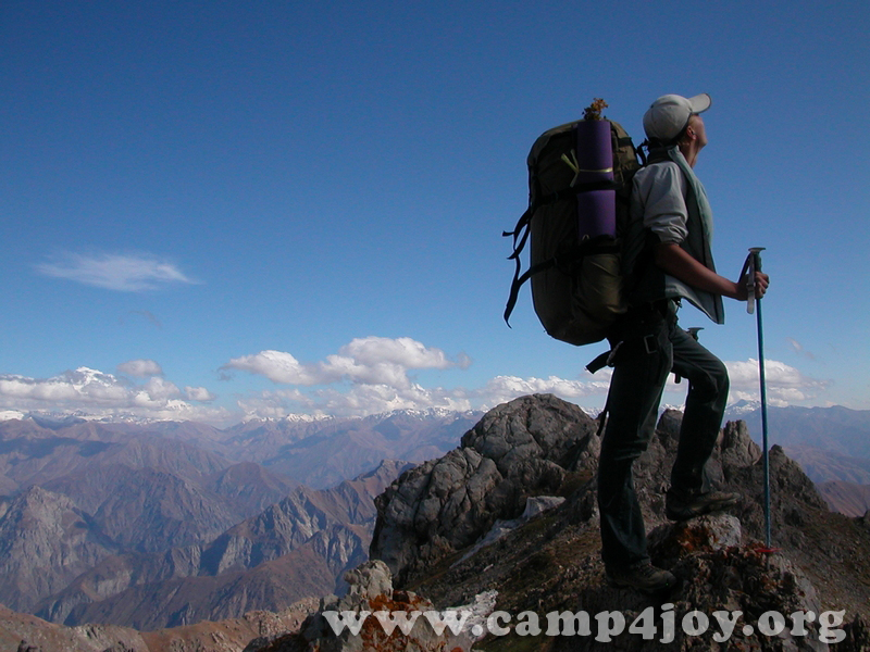
Uzbekistan Mountains near to Tashkent
Chimgan Mountains
The Chimgan Mountains are invariably attractive for mountaineers. The wide variety of Chimgan and its surroundings allows the activity in all kinds of mountaineering and landscape tourism. Mountains (Small and Greater Chimgan Peaks – 3,309 m) of Chatkal range, plateaus, the Black Waterfall (40 m) at the lower part of Greater Chimgan Peak, Gulkam waterfalls, attract a lot of tourists from Uzbekistan and abroad.

Chimgan landscape photographs
West Tien-Shan Mountains Map
 |
||||
 |
||||
 |
Local peculiarities of rafting in Uzbekistan Mountain Rivers

The rivers in the mountains of Uzbekistan have the level six of complexity, and that is why it attracts the attention of the world’s strongest sportsmen.
Rafting along the rapid
Chatkal River is the favorite activity of extreme travelers. They are interested in many-day rafting along the route rated as the route of the fifth
category of complexity, as well as in diverse landscapes and natural obstacles. Not less than fifty serious obstacles await the travelers on the river. Among the hardest ones are waterfalls, cascades of rapids, stony shallow areas with rapid current, whirlpools, rocky gorges and sharp stone cogs sticking out of waves. What makes the Chatkal peculiar is the availability of natural obstacles whose complexity is increasing gradually with climax awaiting the travelers in the lower reaches of the river.
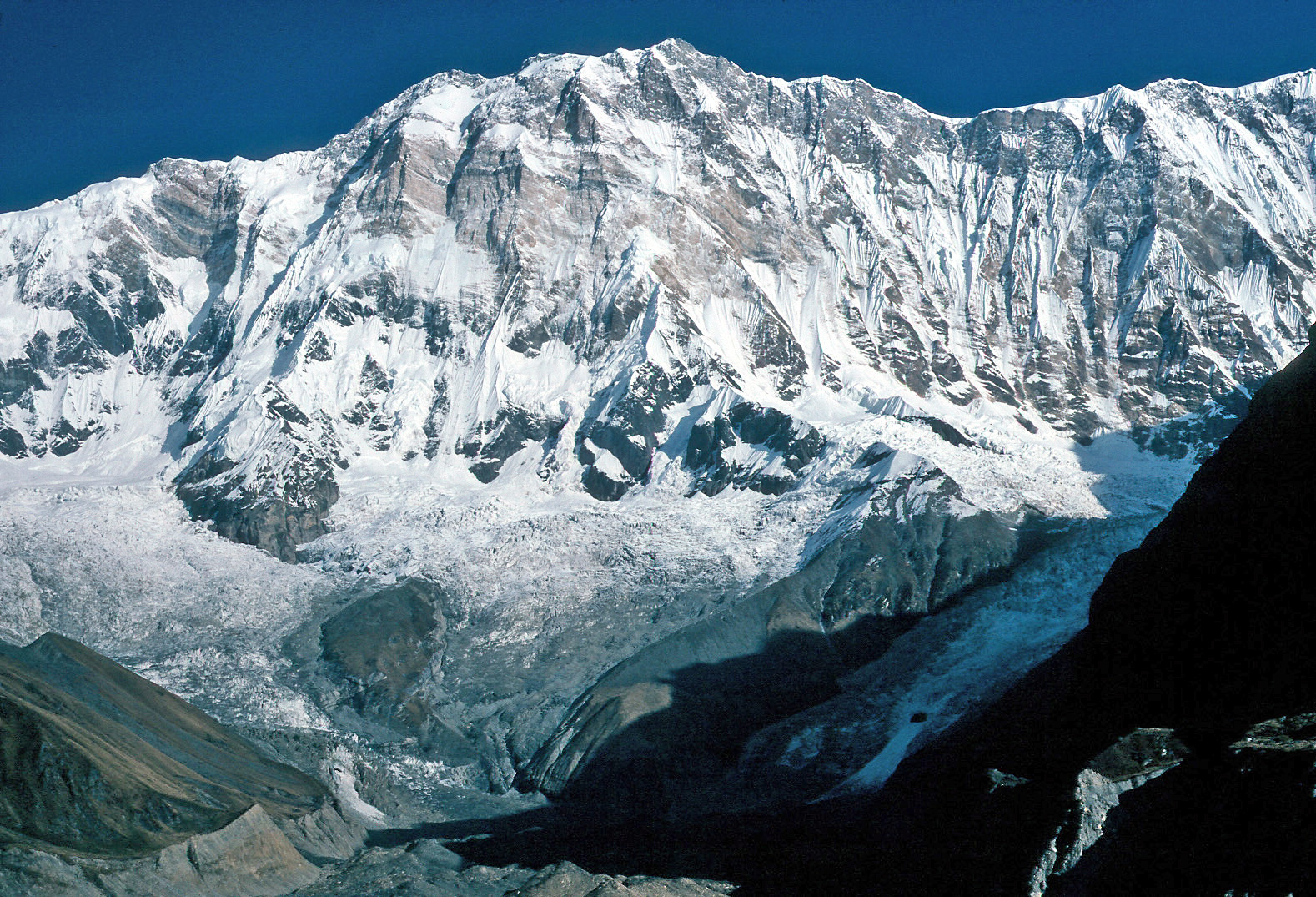
Those who at least once traveled along the Chatkal will never forget the ‘River of Five Canyons‘. This is how tourists call the Chatkal. The nature here is really imposing and amazes the visitor by its primeval beauty. The grandeur of the Second and the Third Canyon Rocks surpasses all imagination. The Second Canyon makes a breathtaking impression by its towering stone walls and slopes. The Third Canyon is rocky; this is a narrow and winding corridor of 200-300 meters high. At the bottom of the rocks there is still blue water, on each side there are wet, bright and dark-grey rocks with sombre entries to grottos and caves. Overhead there is a narrow line of blue sky which is sometimes blocked by dangerously hanging cornices. Here and there the river-bed narrows to 6-8 meters. On the river banks there are floodplain forests and alpine meadows. The odour of thousands of flowers and conifers is brought by the breeze. The wide intermountain depression is framed with the snowcapped mountains of the Chatkal and Sandala Ridges glaring with the snow. Against the background of the dark-blue sky there rises the colossal Peak of Chatkal which is 4503 meters high. It is the highest point of the Western Tien-Shan. Next to it there towers a mountain, which is a little lower than Chatkal Peak – Chatkal Ushba.

The length of the Chatkal is 223 kilometers. And only 183 kilometers is fit for rafting. Difference of the heights between the river head and its estuary reaches 1267 meters.
The waterfall of the First Canyon is rather perilous for all sorts of water crafts; it consists of two steps with the dip for about four meters. After the waterfall there comes a hundred-meter area of steeply-falling rapids. In the middle of the Canyon a real eye-catcher is the inflow of the Chatkal’s big left tributary, the Ters, which falls down the rocky ledge.
Hargush rapids are considered to be the hardest obstacles in the sailing directions of the Chatkal. It spreads for one and a half kilometers and is noted for its powerful overflows through the stone ranges and boulders. In one place stones almost block the river leaving the space of only two or three meters between them. The stream, breaking through the dam falls down by two-meter flow. When going through these rapids, one should take additional safety measures.
After the Hargush rapids, in the order of decrease of complexity, there come rapids of Pigak, Kishlaksay, Second Slalom (Shabrez) and Naizinskiy.
Most dangerous rapids are located in the Fifth Canyon. There is also a two-kilometers section where the rocks come close to each other making a
very narrow rocky corridor. The narrowest part in this section is called a ‘diaphragm’ by tourists. Following this ‘diaphragm’, the river gradually calms down and after two kilometers the corridor ends, as well as the last Canyon itself. The river-bed widens again; pebble and sandbanks are seen on both sides of the river.
Aurahmat is the last rapid in the sailing directions of the Chatkal. It is opened only during at the period of water discharge for irrigation.
Water route along the Chatkal has comfortable but long approaches. One can get to upper reaches of the river both from the Uzbek city of Namangan hrough Chapchama Mountain Pass (2841 meters above sea level) in the Chatkal Ridge – southern variant of access, and from Kazakh city of Toraz hrough Karabura Mountain Pass (3300 meters above sea level) in the Talass Ridge – northern variant of access. Both variants imply nearly equal distances.
The set-off route is much more convenient. From the Ugham-Chatkal National Park, where eight-day rafting tour down the Chatkal River closes, there is a modern highway leading to Tashkent, giving the travelers the opportunity to reach the country’s capital just in two hours.
In case rafting down the Chatkal River is routed through the territory of both Kyrgyzstan and Uzbekistan, ts Oyga’ing, Pskem, Ugham and Ahangaran sections entirely relate to the Uzbek territory.
The route along Pskem and its main part the Oyga’ing river is really unique. In accordance with international classification it falls into the most difficult, the sixth category of complexity. In the world there are few rivers with conditions of rafting similar to Oyga’ing – Pskem section. Among them we can name the Choroh River in Turkey, the Arun in Himalayas, the Blue Nile in Africa and a number of rivers in the Altai Mountains in Russia.
The key obstacles accounting for high technical complexity of the route are as follows: the Big inrush in Oyga’ing where the river runs through fragmental blockings of five stone obstructions, the rapids of Shtolnya and Teparskiy obstruction on the Pskem, where the main waterfall is made up by two rocks converging upward. The very names of the rapids Kovarniy (treacherous), Shtopor (cockscrew), Gorka (hill), Vorota (gates) speak for themselves.
But the above mentioned difficulties should not scare the inexperienced raft-men into avoiding the Pskem. They are recommended to begin to boat or raft down the Pskem river to Charvak Reservoir from Tepar obstruction, or from Pskem settlement, in which case Taparskiy obstruction should be avoided by carrying the boats round this section. Under the first option the length of the descend makes up 20 kilometers, while under the second
option it is twice as long. It must be said that boating and rafting down the rivers is controlled by experienced guides who know the local conditions perfectly well.
Natural beauty in the Oyga’ing and Pskem Valleys can fascinate every traveler whatever experience he or she has. Everything here can make you
be in high spirits: nice weather, the breath-taking beauty of rivers and mountains.
Within the limits of recommended areas for rafting, both above rivers fall into the fourth category of complexity. The best time for rafting is April and May due to good weather conditions. In Uzbekistan this is the time when gardens of the mountain valleys are in blossom. One can hardly find more wonderful natural environs.

The length of rafting route along the Ugham is 11 kilometers. The route starts from “Ugam” resort and finishes in the creek of the river where it flows into the Hojikent water reservoir. On this section raft-men usually make a double trip down the river. The number of obstacles makes your experience really impressive: in some spots the stream will press you against the rocks, in others you’ll need to raft sideways; and all the
way down there are above-water rocks and submerged stones. All this is aggravated by the rapid current. However, in case of emergency situation, prompt mooring and urgent landing can be made at any length of the route.
Rafting down the Ahangaran river takes more time as the route covers the length of thirty kilometers. It starts in the estuary of the Yakkaarchasay river (7 kilometers off the highway bridge before the rise to the Kamchik mountain pass in the Kuramin Ridge) and closes in front of the Angren water reservoir. The most impressive rapids of the route are Ertash and Koksaray rapids.
Reference: Mountain rafting and steppe hiking