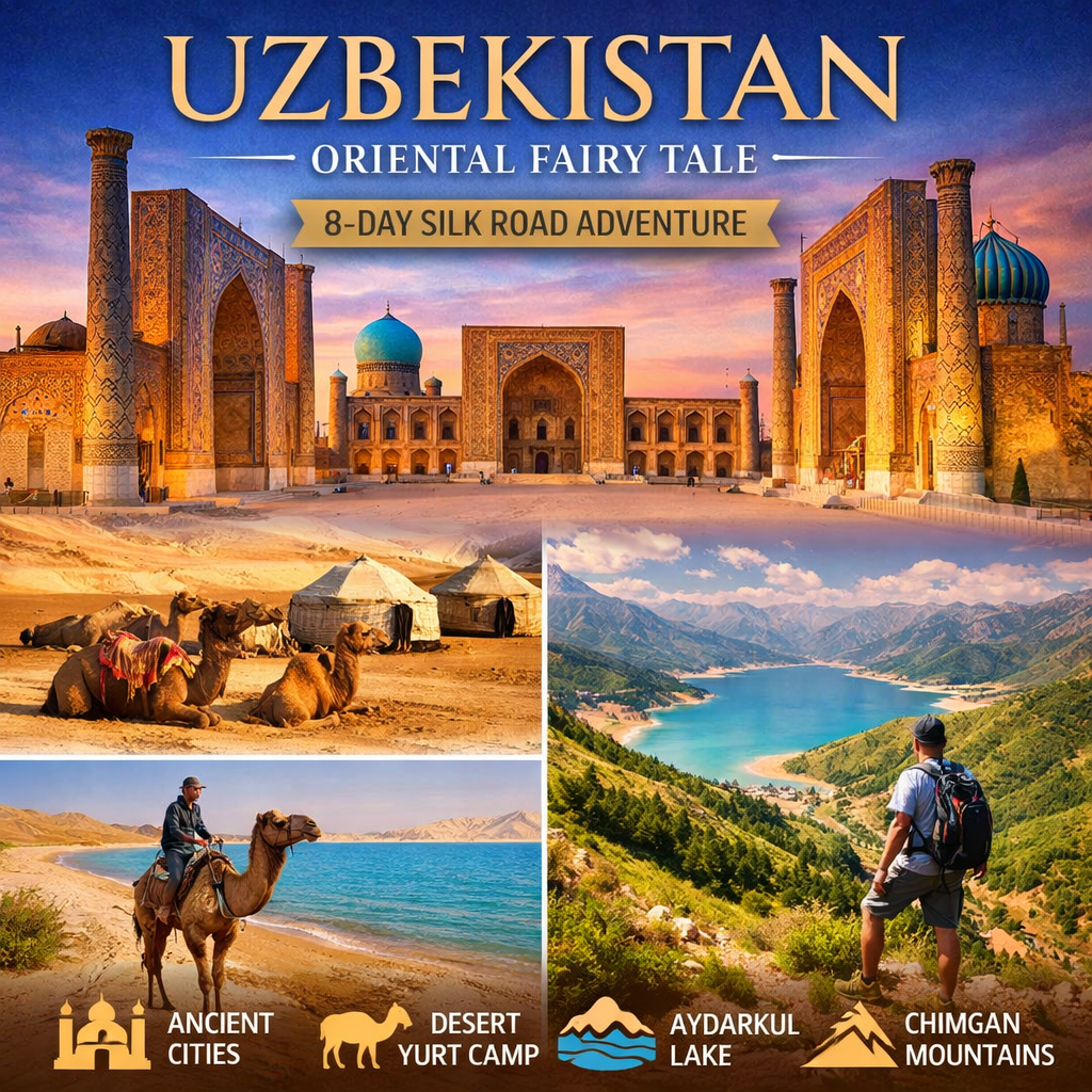
Uzbekistan & Aral Sea Expedition: Across Deserts, Lost Seas, and Silk Road Cities (15 Days)
Discover Uzbekistan like never before — a journey that blends off-road desert adventure, nomadic culture, and the timeless beauty of the Silk Road. From the vibrant streets of Tashkent to the haunting shores of the Aral Sea, this expedition takes you deep into landscapes few travelers ever experience.
Travel by 4×4 vehicles through the Kyzylkum Desert, sleep in traditional yurts under star-filled skies, explore ancient fortresses of Khorezm, and walk through legendary cities like Khiva, Bukhara, and Samarkand.
This is not just a tour — it is a true Central Asian expedition.
Tour Highlights
- 🚙 Jeep expedition across the Kyzylkum Desert
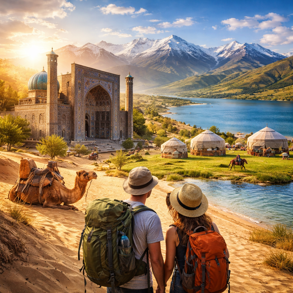
- 🏕 Overnight stays in yurt camps and remote tent camps
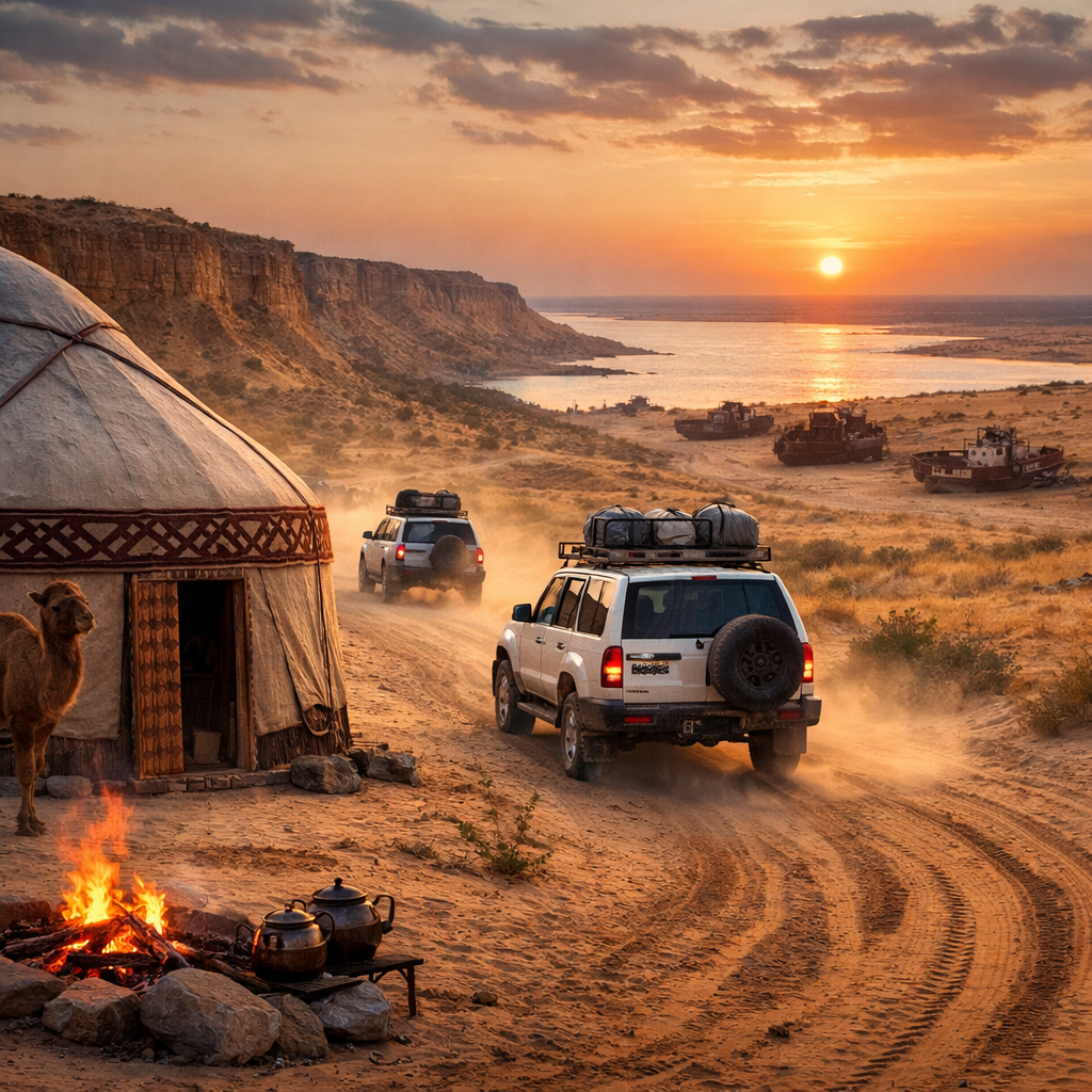
- 🌊 Visit the Aral Sea and the dramatic Ustyurt Plateau
- ⚓ Explore the ship cemetery in Muynak
- 🏛 Discover ancient fortresses like Ayaz-Kala & Djanpik-Kala
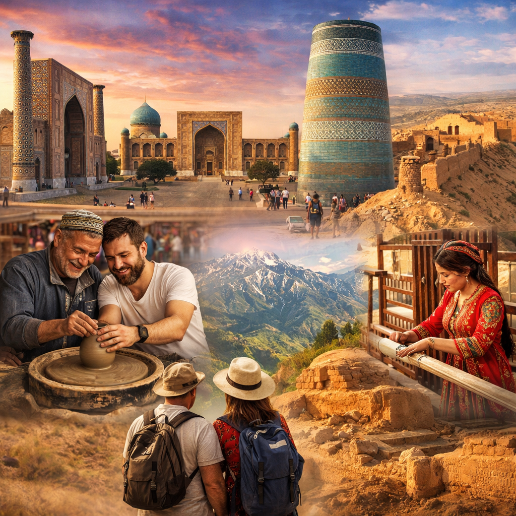
- 🕌 Guided tours in Khiva, Bukhara, Samarkand, and Tashkent
- 🎶 Traditional music by the campfire in the desert
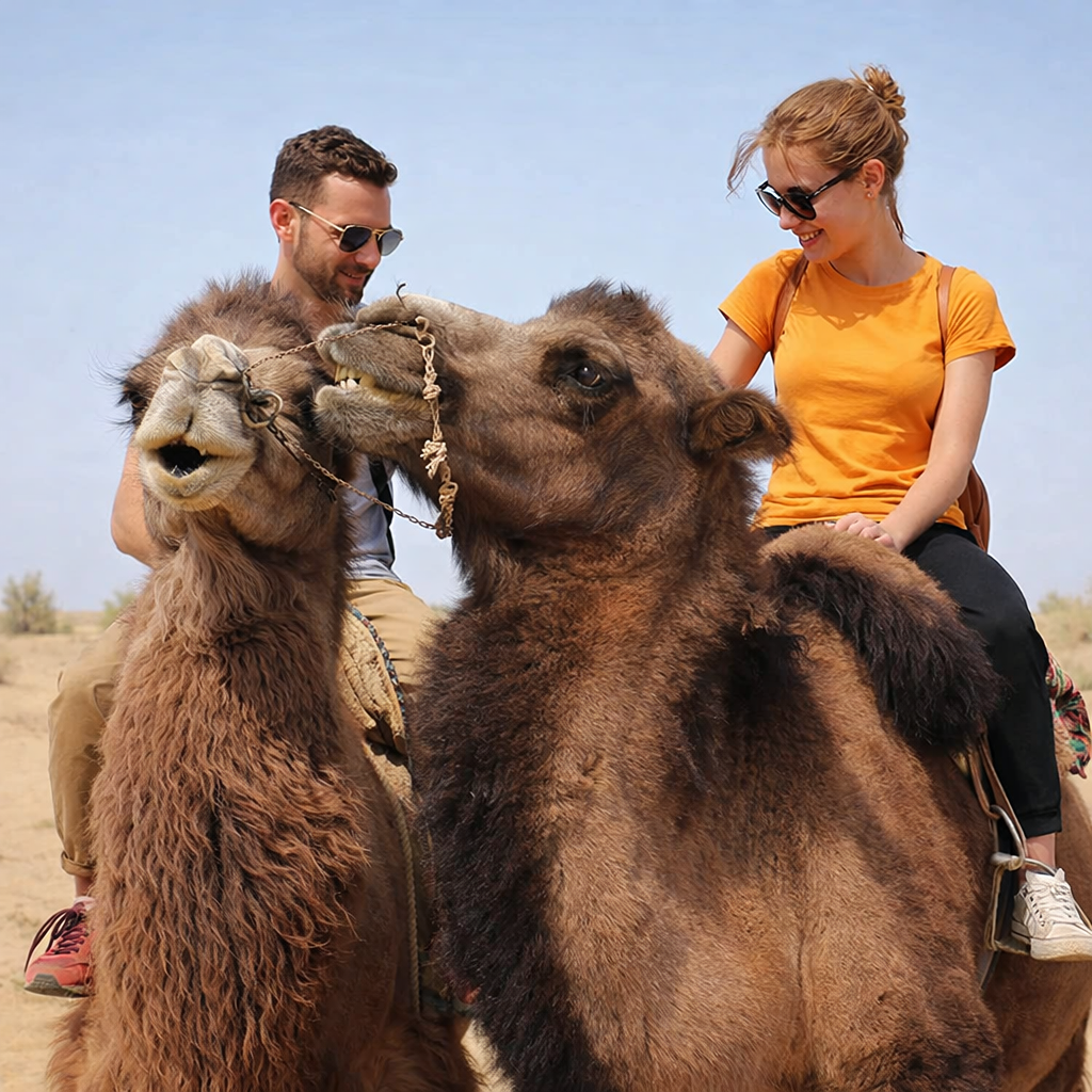
- 🐪 Optional camel ride along Aydarkul Lake
Tour Overview
- Duration: 15 Days
- Season: March – November
- Route: Tashkent → Nurata → Kyzylkum Desert → Aral Sea → Khiva → Bukhara → Shahrisabz → Samarkand → Tashkent
- Style: Adventure + Cultural Expedition
- Group Size: Flexible (private or small group)
Itinerary Summary
Day 1 – Arrival in Tashkent
Arrival, hotel accommodation, and city tour including Old Town, madrasahs, bazaars, and modern landmarks.
Day 2 – Tashkent → Yurt Camp (Safari)
Drive through степи and Nurata mountains to Aydarkul Lake. Overnight in a traditional yurt camp.
Day 3 – Desert & Thermal Springs
Camel rides, lakes, salt flats, and unique desert landscapes. Evening at thermal springs. Overnight in tents.
Day 4 – Bukantau Mountains
Journey through gold-mining regions and mountains with rock art. Discover fossil remains and ancient terrain.
Day 5 – Ayaz-Kala Fortress
Cross the Kyzylkum Desert to ancient Khorezm fortresses. Overnight in a yurt camp near Ayaz-Kala.
Day 6 – Nukus & Savitsky Museum
Visit one of the most unique art museums in the world — the Savitsky collection of Russian avant-garde.
Day 7 – Aral Sea Expedition
Drive across the Ustyurt Plateau to the Aral Sea. Explore cliffs, ancient seabeds, and dramatic landscapes.
Day 8 – Muynak (Ship Cemetery)
Visit the haunting remains of ships stranded in the desert. Return to Nukus.
Day 9 – Khiva (UNESCO Site)
Explore the open-air museum city of Khiva with its minarets, madrasahs, and palaces.
Day 10 – Khiva → Bukhara
Scenic drive through desert landscapes.
Day 11 – Bukhara Exploration
Discover the “Pearl of the East” with its mosques, citadels, and ancient trading domes.
Day 12 – Shahrisabz (Birthplace of Tamerlane)
Explore monumental architecture and historical complexes.
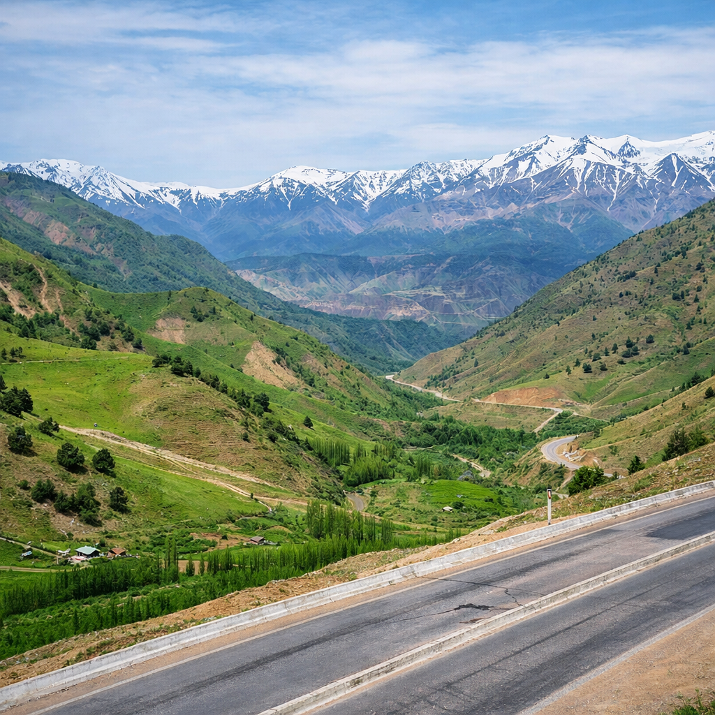
Day 13 – Mountains & Lyangar Village
Visit a sacred mountain village and climb to caves with panoramic views.
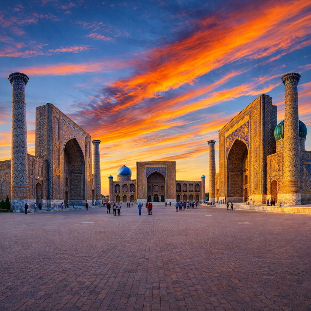
Day 14 – Samarkand → Tashkent
Explore the legendary Registan Square, Bibi-Khanum Mosque, and Gur-Emir Mausoleum.
Day 15 – Departure
Transfer to airport.
Why Choose This Tour
This journey stands out because it combines:
- Extreme landscapes (deserts, plateaus, vanished sea)
- Authentic experiences (yurts, remote camps, local culture)
- Deep history (Silk Road cities and ancient civilizations)
- Rare routes not accessible by standard tours
It is ideal for travelers seeking real adventure beyond classic sightseeing.
Accommodation
- Hotels (3–4★) in cities
- Traditional yurt camps
- Remote tent camps in desert and Aral Sea region
Flexibility
✔ Available on custom dates
✔ Suitable for private groups
✔ Route and services can be adjusted
Book Your Expedition
👉 Ready to explore one of the most unique journeys in Central Asia?
Contact us now to get full details, pricing, and customization options.
Contact Information
📧 Email: pagetour@gmail.com
📱 WhatsApp / Viber / Telegram:
+998 90 188 61 28
+998 90 352 74 83
 Book Your Uzbekistan Journey
 Contact us now to receive: